Hurricane Erin, the first major storm of the Atlantic season, has weakened slightly but remains a powerful Category 4 hurricane.
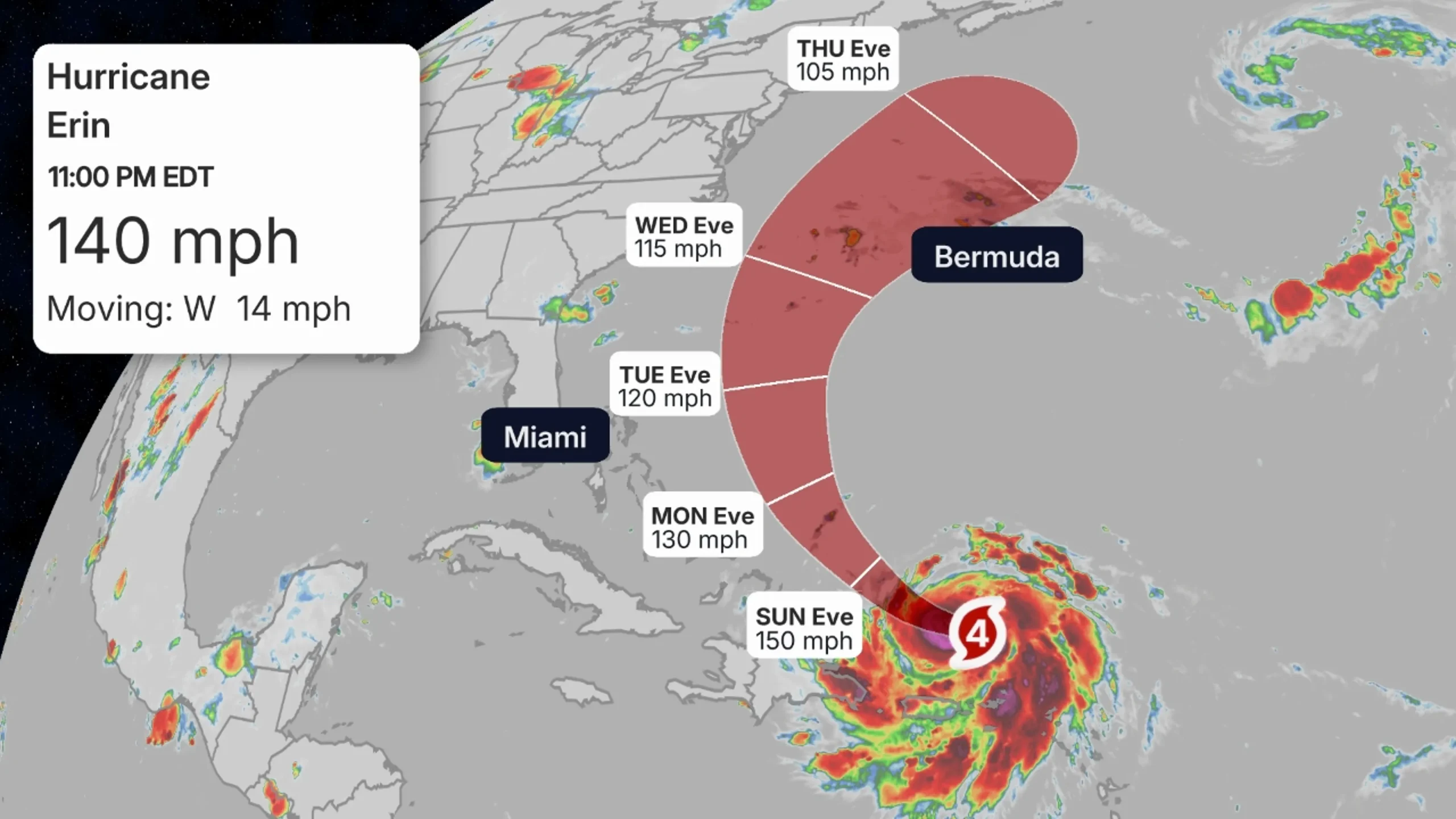
The storm is currently about 395 miles east of Grand Turk Island, with winds near 140 miles per hour. Erin reached Category 5 strength late Friday before losing some intensity.
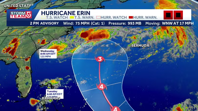
Forecasters say Erin will move west-northwest through the weekend, then curve north early next week. That track should keep it offshore from the United States, but the storm will still generate life-threatening surf and rip currents along the East Coast.
Heavy rainfall of 2 to 4 inches, with isolated totals near 6 inches, is expected across parts of the northern Caribbean. Officials warn of flash flooding and landslides in vulnerable areas.
Computer models show Erin turning north between Bermuda and the U.S. coast, before weakening later this week and possibly reaching Atlantic Canada as a strong extratropical storm.
Hurricane Erin Weakens Slightly After Reaching Category 5, Still a Major Threat in the Atlantic
The 2025 Atlantic hurricane season has begun with a powerful statement. Hurricane Erin, the first named storm to reach major hurricane strength this year, briefly intensified into a Category 5 hurricane on Friday before weakening slightly to Category 4 on Saturday evening.
According to the National Hurricane Center, Erin was centered about 395 miles east of Grand Turk Island with sustained winds near 140 mph. The storm is moving west-northwest at about 14 mph and is expected to gradually turn north early next week.
While no direct landfall is currently forecast, Erin’s vast size and intensity are bringing significant hazards across the northern Caribbean. The Leeward Islands, Puerto Rico, and the Virgin Islands have already experienced outer rain bands, while the Turks and Caicos and the southeastern Bahamas may feel the strongest effects as the storm passes nearby. Rainfall of 2–4 inches, and locally up to 6 inches, could trigger flash floods, urban flooding, landslides, and mudslides.
Beyond the Caribbean, Erin’s impact will be felt along the U.S. East Coast. Large swells are expected to reach Bermuda and the U.S. shoreline by Monday, creating dangerous surf conditions and rip currents. Even without a direct strike, forecasters emphasize that coastal residents should remain vigilant.
Most forecast models indicate that Erin will curve away from the United States, steered by an Atlantic high-pressure system and an approaching cold front. However, the storm is likely to remain strong into the coming week, before weakening and possibly transitioning into an extratropical cyclone near Atlantic Canada.
Erin’s explosive growth highlights a troubling trend of rapid intensification fueled by unusually warm ocean waters. Experts note this could be a recurring theme during the 2025 season, which is forecast to be more active than average.